
RIO AMAZONAS
RIO AMAZONAS
EL RIO AMAZONAS, UBICADO EN SURAMERICA, ES EL RIO MAS LARGO,EL MAS CAUDALOSO Y EL QUE TIENE LA CUENCA DE MAYOR SUPERFICIE DE NUESTRO PLANETA,SU LONGITUD ES DE ( 6800 KM ), SUPERA A LA DEL RIO NILO EN MAS DE CUARENTA KILOMETROS .

Antes de la conquista, el río no tenía un nombre único; por el contrario, los indígenas nombraban indistintamente a las diferentes secciones con voces como Paranaguazú (Gran Pariente del Mar), Guyerma, Solimões, etc. En 1500, Vicente Yañez Pinzón, comandante de una expedición de exploración española, se convirtió en el primer europeo en aventurarse por el río luego de descubrir que sus aguas eran navegables y bebibles. Pinzón llamó al curso de agua el río Santa María de la Mar Dulce, que finalmente fue abreviado a Mar Dulce (nombre que también se dio en esas épocas al Río de la Plata). Durante algunos años posteriores a 1502 también se le conoció como Río Grande y Orellana. Los compañeros de Pinzón bautizaron al desaguadero como río Marañón, voz de probable origen indígena. Es posible también que el nombre derive del español maraña, en representación de las enormes dificultades que aquellos hombres encontraron al explorar el área. Otras fuentes aseguran que el nombre del río se deriva de que los marinos, al comprobar que no podían ver desde una orilla la opuesta, se preguntaban en latín: Mare an non? (¿Es mar o no?). En todo caso, la designación ha persistido hasta nuestros días en el del Estado brasileño de Maranhão y en el del río homónimo en el Perú.
La voz Amazonas proviene de río de las Amazonas, dado al Marañón por Francisco de Orellana luego de enfrentarse a una etnia local en la cual hombres y mujeres se defendían por igual. Orellana derivó el nombre del mito griego de las guerreras amazonas de Asia y África, narrado por Heródoto y Diodoro. Sin embargo, es muy probable que la palabra Amazonas fuera una deformación por falso amigo paronomásico de una palabra indígena cuya pronunciación a oídos españoles era semejante a «Amazonas», palabra indígena que significaba «rompedor de embarcaciones»; esto especialmente entre los marayoara, que podían observar el tremendo macareo («pororoca») que este río provoca al contactar en su desembocadura con el océano Atlántico.
Tradicionalmente se asigna al Amazonas el segundo puesto en longitud total, detrás del Nilo, aunque no ha existido nunca un consenso generalizado sobre cuáles son los puntos de medición aceptables. Las últimas investigaciones, empero, añaden unos 740 km más al cauce, lo que lo colocaría definitivamente en el primer puesto de la clasificación de ríos más largos del mundo.

Según las mediciones más conservadoras, el río tiene unos 6.762 km de largo. Sin embargo, una expedición peruano-brasileña que ha concluido sus labores en junio de 2007 ha calculado 6.800 km.[2] Presenta secciones de gran variabilidad en el cauce. En la desembocadura la distancia de una ribera a la otra es de cerca de 330 km, medidos entre Cabo do Norte a Punto Patijoca e incluyendo la isla de Marajó (pronúnciese: Maraŷó), del tamaño de Dinamarca y el delta del río Pará (tramo final del río Tocantins), de unos 60 km de ancho. La distancia de las bocas del Amazonas, formadas por una especie de delta disimulado por la acción de las mareas y de las corrientes marinas, es de unos 100 km aproximadamente.
Actualmente, por recientes informes de investigaciones, La Sociedad Geográfica de Lima, respaldada por entidades de la comunidad científica internacional, puso fin a la polémica sobre el origen del río Amazonas al determinar que nace en los Andes del sur de Perú y es el más largo del mundo, superior al río Nilo en más de cuarenta kilómetros.
Desde su nacimiento en la quebrada Apacheta, en las faldas del Nevado Mismi, en el departamento de Arequipa, a 5.150 metros de altitud, hasta su desembocadura en el Atlántico tras recorrer Perú y Brasil, alcanza una longitud de 7.062 kilómetros.
Esto lo hace 391 kilómetros más largo que el Nilo, en Africa, que se extiende por 6.671 km, según dijeron el experto Zaniel Novoa, de la Sociedad Geográfica limeña, y el periodista y explorador polaco Jacek Palkiewicz, quien en 1996 encabezó una expedición multinacional hacia la naciente del Amazonas. Se llegó a establecer esa medición, que al cabo de 12 años fue validada por importantes entidades de la comunidad científica internacional. Entre ellas figuran la Sociedad Geográfica de Londres, la Academia de Ciencias de Rusia y el Instituto Brasileño de Pesquisas Espaciales.
Siguiendo la costa, ligeramente al norte del cabo del Norte y por 160 km, existe un cinturón de islas semisumergidas y bancos de lodo superficiales. De esta particular geografía, cuya profundidad no supera los 7 m, nace el fenómeno de la pororoca, una marejada que avanza con un rugido de intensidad creciente, a unos 15 a 25 km/h, formando una pared de agua de 1,5 a 4 m de altura. Esta dinámica es la razón de la ausencia de delta anteriormente mencionada: el océano rápidamente arrastra, durante el reflujo o bajamar, el vasto volumen de lodo acumulado, impidiendo parcialmente la formación de islas intermedias.
CASCADA SAN RAFAEL

El primer europeo que navegó en la cercanías del estuario del Río Amazonas fue Américo Vespucio en el 1499. Después los españoles Vicente Yáñez Pinzón y Diego de Lope exploraron las islas que hacen parte del enorme estuario. El primer descenso del Amazonas desde los Andes por europeos fue realizado por Francisco de Orellana en 1541. El primer ascenso del río por un europeo fue en 1638 por Pedro Teixeira, portugués, quien invirtió la ruta de Orellana y alcanzó Quito a través del río Napo. Regresó en 1639 con los padres jesuitas Acuna y Artieda, delegados del virrey del Perú para acompañar a Teixeira.
Francisco de Orellana partió de Guayaquil el 4 de febrero de 1541; llega a Quito y reorganiza su caravana conformada por 23 hombres. Orellana y sus hombres sostuvieron varios combates con las tribus belicosas que salían a su paso, sufriendo así varios contratiempos. Al pasar el tiempo, día a día los expedicionarios iban muriendo, los abastecimientos se iban agotando, hasta no tener ni qué comer. Era ya diciembre y la mayoría de los expedicionarios se dieron cuenta de que la expedición no llegaría al lugar que se buscaba, por lo que comenzaron a sublevarse. Pero tanta fue la fe y la perseverancia que, el 12 de febrero de 1542, se descubre el inmenso río mar.
El nombre de «río de las Amazonas» fue puesto por Francisco de Orellana después de haber tenido un combate con unas mujeres intrépidas y guerreras, con las cuales combatió el 24 de junio de 1542.

El río Amazonas nace en las faldas del nevado Mismi, en Arequipa, Perú. Entre los diversos nombres que recibe el río Amazonas a lo largo de su curso, destacan, sucesivamente, los siguientes: Lloqueta, Apurímac, Ene, Tambo, Ucayali, Marañón y Amazonas. Cuando el río entra en Brasil pasa a denominarse río Solimões durante un buen tramo. Luego vuelve a adoptar el nombre de río Amazonas en la confluencia con el río Negro.

Luego de la confluencia entre el Apurímac y el Ucayali el río deja atrás el territorio andino y entra en una planicie aluvial inundable y suavemente ondulada.
Recorre también la frontera peruano-colombiana y después hace frontera tripartita con Brasil.
Ya en Brasil, el río Negro une su caudal al Amazonas lodoso, observándose el contraste notorio de colores de las aguas, que prácticamente no se entremezclan durante unos 230 km, debido a la diferencia de densidades y de temperatura y, sobre todo, a la similar profundidad y velocidad de las dos corrientes fluviales en el punto de confluencia.
En algunos puntos, por largas distancias, el río se divide en dos cursos principales con canales laterales conectados por un complicado sistema de riachos, que cortan las islas Igapo (que rara vez superan los 5 m de elevación sobre la mínima cota en islotes menores.
En las angosturas de Óbidos, a 600 km del mar, el río se estrecha, discurriendo en una única corriente de 1,6 km de ancho y 300 m de profundidad, con una velocidad promedio de 7 km/h.
Desde la isla de Canaria en la Gran Curva hacia el río Negro. 1.000 km corriente abajo, sólo se encuentran tierras muy bajas, similares a las de la desembocadura. Vastas extensiones del terreno están completamente anegadas, incluso profundamente, asomando por sobre el agua sólo las copas de los árboles.
Desde cerca de la desembocadura del río Negro hasta Serpa, en la margen opuesta al río Madeira, las orillas del Amazonas son bajas, comenzando a elevarse en las cercanías de Manaos, formando colinas suaves. En Óbidos, el sistema evoluciona hasta transformarse en una barranca de 17 m rodeada de colinas bajas. El bajo Amazonas podría haber sido en el pasado un golfo en el Atlántico, cuyas aguas erosionaron las colinas cercanas a Óbidos.
Sólo un 10% del agua transportada por el río penetra en la poderosa corriente de Óbidos, muy poco de la cual se origina en la pendiente Norte del valle. El área de drenaje del Amazonas al oeste de Óbidos es de unos 5 millones de km² y hacia el este, de 1 millón de km² (aproximadamente un 20%).
En el curso inferior del río, la orilla norte consiste en una serie de abruptas mesetas que se extienden por unos 240 km desde el margen opuesto a la desembocadura del río Xingú (en español pronunciase Shingu o Šingu) hasta Monte Alegre.
Estas estructuras están cortadas en forma de terrazas. Monte Alegre alcanza una altura de varios cientos de metros. En la margen meridional, sobre el río Xingú discurre una línea casi interrumpida de barrancas bajas que bordean la planicie aluvional y se extienden casi hasta Santarém. El conjunto es una sucesión de grandes curvas que finalmente tuercen hacia el Suroeste y se funde con las colinas que forman el margen aterrazado del valle del río Tapajós (o mejor, Tapaŷós).
El sistema fluvial del Amazonas tiene más de 1.000 ríos tributarios de importancia, siendo más de 25 los ramales que superan los 1.000 km de longitud. Se suele considerar que el río Amazonas nace nominalmente cerca de Nauta en el Perú, en la confluencia de los ríos Marañón y Ucayali, aunque al llegar a la triple frontera, al entrar en territorio brasileño tiene un tramo que se conoce como río Solimões, que llega hasta la confluencia con el río Negro, en Manaos. Aguas abajo vuelve a recuperar el nombre de río Amazonas. Por ello, para facilitar la localización de los afluentes, se ha dividido el sistema fluvial del río Amazonas en cinco tramos: Ucayali – Marañón – Amazonas – Solimões – Amazonas. Además, se ha añadido el ramal desdoblado del río Pará, para recoger la cuenca del río Tocatins, que en puridad, no es un afluente del Amazonas, aunque en algunas ocasiones se añade. En la tabla se señalan los afluentes con una (d) a los situados al sur, esto es aguas abajo sobre el margen derecho, y con una (i) los situados al norte, esto es aguas abajo sobre la margen izquierda del río.
CATARATAS DE IGUAZU

CAUDAL
El Amazonas transporta más agua que el Misisipi, el Nilo y el Yangtze juntos; su área de drenaje o cuenca es asimismo la mayor del mundo. El volumen de agua llevado hacia el Atlántico es enorme: con un promedio anual de 230.000 m³/s, alcanza hasta 300.000 m³/s en la temporada lluviosa. En efecto, el Amazonas es responsable de la quinta parte de todo el agua dulce incorporado a los océanos de la Tierra. Además, esa agua es perfectamente potable mar adentro de la desembocadura, hasta una distancia desde la cual la costa ya no es visible. La salinidad del océano Atlántico es notablemente inferior en un radio de varios miles de kilómetros alrededor de aquel punto hacia el norte de su desembocadura: cabe recordar que en esta zona las corrientes marinas traen el agua salada hacia la desembocadura y no al revés.
El área o cuenca de drenaje del río es de aproximadamente 7.050.000 km², un 40% de la de América del Sur. Sus nacientes se extienden desde los 5º de latitud Norte hasta los 15º de latitud Sur. Recorre la selva cálida y húmeda (una pluviselva) más grande del planeta, Amazonia o selva amazónica. La pluviselva amazónica (hasta el inicio del actual recalentamiento global) se viene caracterizando por sus casi constantes lluvias convectivas, esto es: el gran caudal de agua que el calor solar evapora desde la superficie de la cuenca imbrífera del Amazonas asciende a gran altitud precisamente por las corrientes térmicas (corrientes verticales de aire caliente) hasta que, al llegar a zonas altas de la atmósfera, más frías, se condensa en gotas y éstas casi inmediatamente se transforman, sobre la misma cuenca, en copiosas lluvias, lo cual forma un ciclo natural de retroalimentación hídrica.
Las lluvias estacionales dan origen a grandes inundaciones a lo largo del curso del río y sus tributarios. La profundidad promedio en el pico de la estación lluviosa es de unos 40 m y el ancho promedio es de unos 40 km (véase: Barzea). Esta se inicia en noviembre y va hasta junio, para luego decrecer a fines de octubre. La crecida del río Negro es parcialmente asincrónica: la estación lluviosa no comienza en este valle sino hasta febrero o marzo. Para junio se encuentra en su punto culminante, y comienza el descenso de las aguas ahora sí en consonancia con el Amazonas. El río Madeira presenta un desfasaje de dos meses, comenzando a crecer en septiembre e iniciando la retirada en abril.
La abundancia de agua en el sistema amazónico se debe al hecho de que gran parte del territorio se encuentra ubicado en la zona de convergencia intertropical, donde la caída de lluvias es máxima. Asimismo la región se halla en la área de intercambio de vientos donde la humedad del Atlántico es empujada hacia el oeste y eventualmente forzada a ascender sobre los Andes. Este ascenso enfría las masas de aire, creando lluvias intensas que se precipitan a lo largo de una superficie enorme, proceso sin parangón a nivel mundial.
La suave planicie aluvional (llamada vargem) que constituye la mayor parte del territorio por donde corre el río, queda cubierta con hasta 15 m de agua. El nivel en Iquitos es de 6 m, en Teffe, 15 m, en Óbidos, 11 m y en Pará 4 m sobre el nivel fluvial mínimo que caracteriza la estación seca.
FUENTES DEL AMAZONAS

FLORA Y FAUNA
Toda la flora y fauna de la selva intertropical húmeda americana está presente en la Amazonia.
Allí existen innumerables especies de plantas, miles de especies de aves, incontables anfibios y millones de insectos todavía sin clasificar.
La fauna es muy variada, desde los insectos más pequeños hasta los grandes mamíferos como el jaguar, el puma, el tapir y varias especies de venados. También hay reptiles como tortugas, caimanes, babillas y serpientes. Hay aves y peces de todas las especies, plumajes y escamas. En las lagunas a lo largo del Amazonas florece la planta Victoria Regia, una especie de nenúfar cuyas hojas circulares alcanzan más de un metro de diámetro y en ocasiones, hasta 5 m, lo que ha dado pie al mito de que una de estas hojas puede sostener a una persona, lo cual es falso.

La inmensa selva ecuatorial oculta una fauna abundante, aún pendiente de una clasificación completa. En la Amazonia existen 4.000 especies de mariposas, más de 3.000 de peces de agua dulce, 1.700 de aves y el 20% de las especies de primates del planeta. Bajo su extraordinaria frondosidad conviven diferentes hábitats y la mayor diversidad genérica del mundo animal. La riqueza biológica se explica porque durante millones de años el ecosistema amazónico ha permanecido inalterado.
Entre sus aguas se encuentran varios de los peces mas grandes de agua dulce,arapaimas,piraibas,pirararas,payara,jau,tambaqui,tucunare,muchas especies de siluriformes,raya de agua dulce, anguila electrica etc.
PIRARARA

ARAPAIMA

TAMBAQUI

SURUBI

PIRAIBA

PAYARA

JAU

VIDEO
Es tan amplio su aporte en especies de peces y plantas acuáticas que enumerarlas todas no es tarea fácil. Para los aficionados al acuarismo, se trata de la fuente que provee la mayor cantidad de especies piscícolas que pueblan los comercios y acuarios de todo el mundo.
También alberga una gran cantidad de anfibios de todo tipo, como ranas, sapos, tritones, salamandras y anfibios aún sin conocer.
Tras recorrerlo en una de sus expediciones, el famoso oceanógrafo Jacques-Yves Cousteau llegó a afirmar que “hay más especies de peces en el Amazonas que en el océano Atlántico”.
UN SALUDO A LOS AMIGOS DE PESCAPROFESIONAL
happy wheelsLorenzo Martinez Bernal
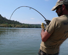
Pescador y guia profesional especializado en la pesca del siluro al lanzado desde embarcacion y a pellets.Si quieres pasar un dia inolvidable de pesca de este gigante de rio contacta con nosotros a traves del formulario de contacto de Guia De Pesca.
Articulos relacionados


Más en esta categoría


7 thoughts on “RIO AMAZONAS”
Leave a Reply
Lo siento, debes estar conectado para publicar un comentario.
GUIA DE PESCA DEL SILURO – +34 693464214
LORENZO MARTINEZ – GUIA DE PESCA
EN EL RIO EBRO, EMBALSE DE MEQUINENZA />
/>
PESCADOR Y GUIA PROFESIONAL, EXPECIALIZADO CON MAS DE 25 AÑOS DE EXPERIENCIA EN LA PESCA EXCLUSIVA DEL SILURO AL LANZADO DESDE EMBARCACION Y EN LA PESCA FIJA CON PELLETS DESDE ORILLA, CLONK Y BREAK LINE. TAMBIEN GUIAMOS LA PESCA DE GRANDES CARPAS,LUCIOPERCAS Y PERCAS FLUVIATILIS. SI QUIERES PASAR UN DIA INOLVIDABLE DE PESCA, CONTACTA CONMIGO A TRAVES DE NUESTRO NUMERO DE TELEFONO: 693-464214. DISPONEMOS DE VARIOS TIPOS DE ALOJAMIENTOS EN LA ZONA DE PESCA, EN CONSONANCIA CON VUESTRO PRESUPUESTO. OS INFORMAREMOS DE NUESTROS SERVICIOS SIN NINGUN COMPROMISO.
TURISMO ACTIVO DE ARAGON
EN NUESTRA EMPRESA, CUMPLIMOS CON TODOS LOS REQUISITOS QUE EXIGE EL GOBIERNO DE ARAGON PARA EL SERVICIO DE GUIA DE PESCA, CONTAMOS CON LOS SEGUROS DE RESPONSABILIDAD CIVIL Y SEGURO DE ACCIDENTES, PARA MAYOR COBERTURA A NUESTROS CLIENTES.-


CAMPEONATO DEL MUNDO DE PESCA DEL SILURO CON PELLETS EN CHIPRANA


GUIA DE PESCA DEL SILURO
-
 PESCA CON GUIA DEL SILURO EN MEQUINENZA En pescaprofesional,somos guias de pesca del siluro, en...
 -
 PESCA DEL SILURO CON GUIA EN EL RIO EBRO PESCA DEL SILURO CON GUIA EN EL RIO EBRO Pesca del siluro...
 -
 GUIAS DE PESCA DEL SILURO PARA NIÑOS GUIAS DE PESCA DEL SILURO PARA NIÑOS En pescaprofesional,...
 -
 GUIA DE PESCA DE SILUROS Y GRANDES CARPAS EN MEQUINENZA RIO... GUIA DE PESCA DE SILUROS Y GRANDES CARPAS EN MEQUINENZA RIO...
 -
 PESCA DEL SILURO Y CARPAS EN OTOÑO PESCA DEL SILURO Y CARPAS EN OTOÑO LA MEJOR ESTACION PARA...
 -
 GUIA DE PESCA DE SILUROS XXX GUIA DE PESCA DE SILUROS XXX, PESCA EXTREMA DE LOS GRANDES...
 -
 GUIA DE PESCA DEL SILURO CON PELLETS EN MEQUINENZA GUIA DE PESCA DEL SILURO CON PELLETS EN MEQUINENZA En...
 -
 GUIA DE PESCA DEL SILURO EN MEQUINENZA GUIA DE PESCA DEL SILURO EN MEQUINENZA GUIA DE PESCA DEL...
GUIA DE PESCA DE LA CARPA
-
 PESCA GUIADA DEL SILURO Y GRANDES CARPAS EN SEPTIEMBRE PESCA GUIADA DEL SILURO Y GRANDES CARPAS EN SEPTIEMBRE En...
 -
 VIAJES DE PESCA DE LA CARPA VEN A PESCAR CON NOSOTROS LAS GRANDES CARPAS DEL...
 -
 SILUROS Y CARPAS AL PELLETS SILUROS Y CARPAS AL PELLETS EN LAS AGUAS DEL RIO EBRO...
 -
 VACACIONES DE PESCA DE SILUROS VACACIONES DE PESCA DE SILUROS VEN CON NOSOTROS DE...
 -
 CARPFISHING EN EMBALSE DE MEQUINENZA CARPFISHING EN EMBALSE DE MEQUINENZA ESTAMOS EN BUENAS...
GUIA DE PESCA DE LA LUCIOPERCA Y PERCA
-
 GUIA DE PESCA DEL SILURO Y LUCIOPERCA AL LANCE EN... GUIA DE PESCA DEL SILURO Y LUCIOPERCA AL LANCE EN...
 -
 GUIA DE PESCA DE LA LUCIOPERCA EN MEQUINENZA GUIA DE PESCA DE LA LUCIOPERCA EN MEQUINENZA En...
 -
 PESCA DE LA PERCA PESCA DE LA PERCA En aguas del embalse de Mequinenza, soy...
 -
 GUIA PESCA LUCIOPERCA PERCA GUIA PESCA LUCIOPERCA PERCA Guia pesca lucioperca ...
 -
 PESCA DE LA LUCIOPERCA Y PERCA PESCA DE LA LUCIOPERCA Y PERCA Guía de pesca de la...

bn bn esta pagina me servio de mucho
Impresionante te deja sin palabras,hay que cuidarlo ya que de el depende gran parte de nuestra existencia.-
Exquisita información, muy enriquecedora, completa, e ilustrativa.
QUE INCREIBLE NATURALEZA, ES MARAVILLOSO SABER ESTO!!!!!!!
Muy bueno e interesante, gracias por compartir las extrañas maravillas del amazonas, nuestro planeta no deja de sorprendernos!!!
esos pescados me sorprendieron nunka avia visto un pescado se ese tamaño es impresionante guagu